 Corridor Utility Partners
Solutions · Route & GIS Engineering
Routing is an engineering problem, not drafting.
A corridor is engineered when the proposed route has been resolved against everything already in the ground and everything that constrains construction. We produce that resolution, and the GIS/CAD deliverables that carry it.
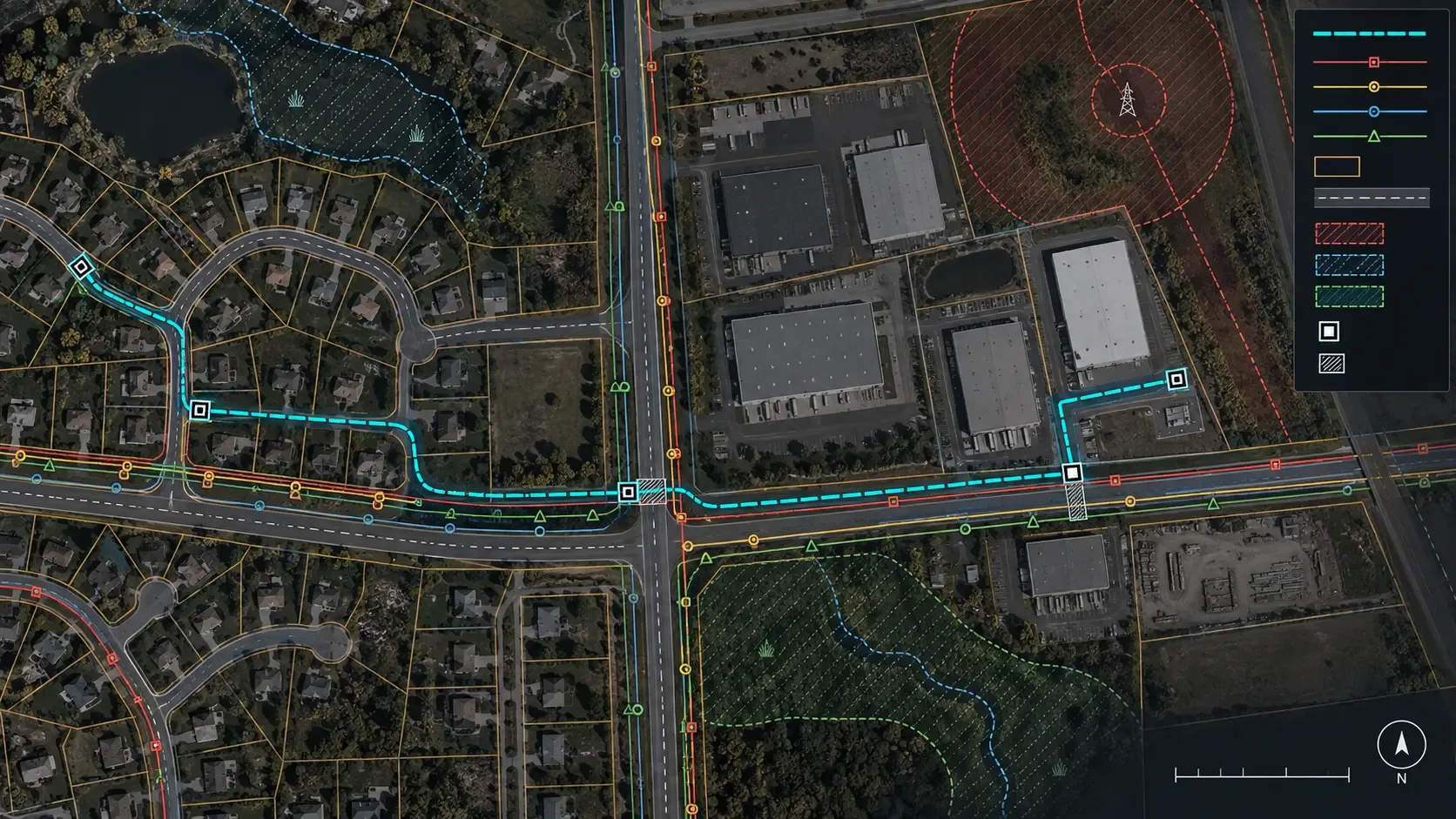
The engineered corridor
What a route has to be resolved against.
Proposed Route+Existing Utilities+Roads+Parcels / ROW+Crossings+Environmental / Physical Constraints+Constructability=Engineered Corridor
- Existing utilities — locate records, as-builts, conflict registers; separation and clearance rules from your standards
- Roads and crossings — road and rail crossings, casing and trenchless options, traffic and permit constraints
- Parcels and ROW — right-of-way limits, easements, landowner interfaces, permit boundaries
- Environmental and physical constraints — wetlands, watercourses, flood defences, soils, existing structures
- Constructability — access, working space, phasing, protection of existing assets
- Decision record — variants, trade-offs and the note that justifies the chosen route
GIS / CAD production
Design-ready inputs. Drawing sets inside your standards.
GIS, survey, as-built and utility-locate data become design-ready inputs; plan, profile and section production runs inside your templates, layer standards and GIS/WMS schema; deliverables hand back cleanly to your systems.
- AutoCAD-based drafting with LISP automation; geospatial data preparation and QA
- Plan / profile / section sets, material take-offs, detail sheets
- Consistent round-trip between geospatial systems and design deliverables

Next
Where this connects.
Discuss a route or GIS package.
A corridor study, a route drawing set or recurring GIS/CAD production: tell us the scope.
Discuss a project →